The Supreme Navigators of History: Voyagers of the Pacific
By | April 25, 2019
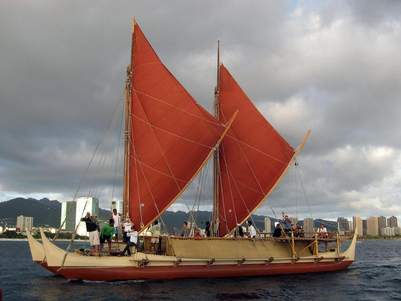
HÅkÅ«le`a, a Hawaiian wa'a kaulua or voyaging canoe, sailing off Honolulu. Source: (wikimedia.org)
The Pacific Ocean covers more than 60 million square miles of the Earth, more than 30 percent. It contains double the amount of water from the next largest ocean, the Atlantic. If you took all the continents and combined them, they would all fit inside the Pacific Ocean with room to spare. In it are roughly 25,000 islands of which more than 10,000 are considered a part of Oceania which is divided into four regions: Australia, Melanesia, Polynesia, and Micronesia.
Micronesia and Polynesia are the most remote and intriguing regions since these areas began to be settled by seafaring colonists as early as 2,000 years ago. Over the centuries, these people managed to settle lands as remote as Hawaii which is 2,400 miles from the nearest landmass and Easter Island which is nearly 2,200 miles from the closest shore.
The people who colonized these remote pinheads in the Pacific did it without compass, sextant, global positioning systems, or Google maps.
So why did they do it?
Polynesian Double Hulled Canoe. Source: (teara.govt.nz)
The reasons why the Polynesians would spread across the vast distances of the Pacific are numerous. Population pressures, the need to raid and conquer, the need for better fishing grounds, as well as a sense of adventure, are all valid, human reasons. Then, of course, there are cases of accidents happening such as ships getting swept away by storms and depositing stunned sailors on the shores of a new island.
How they managed this feat is truly impressive.
Distribution of people across Oceania. Source: (en.wikipedia.org)
The first trick was to build vessels that could voyage for hundreds of miles across the empty ocean. Micronesians used large outrigger canoes and Polynesians tended to use double-hulled canoes. The term canoe trivializes this craft since they reached up to 70 feet in length could carry up to 100 persons and travel up to 150 miles per day with a fine wind to push its sails.
Construction varied from island to island but typical methods would use coconut fiber for caulking and breadfruit sap for pitch. Remarkably, they built these ships using stone age technology. But the results were impressive. The famous explorer, Captain James Cook saw these ships first hand and pronounced them “fit for distant navigation.”
A Micronesian proa, aka prau, perahu, and prahu from the Caroline Islands in the Pacific. From Enciclopedia Ilustrada Segui, published c. 1900. Source: (Universal History Archive/UIG via Getty Images)
The second trick is to provision your ship. The Polynesian ships could carry a considerable load of supplies including breadfruit, pounded taro, and coconuts, which was stored between the double hulls. Fish caught at sea were either eaten raw or cooked over a coconut husk fire in special fire bowls. One expert estimated that the provisions could carry a Polynesian vessel for up to forty days, giving it a range of up to 4,500 miles in perfect conditions.
A Canoe of the Sandwich Islands, Rowers Masked. Source: (Historical Picture Archive/CORBIS/Corbis via Getty Images)
Once you have your ship and it is loaded with supplies, you need to figure out where to go. The Polynesians, as well as the other peoples of Oceania, used celestial navigation. During clear days the sun was used as a reliable compass. On clear nights, they studied guide stars that were near the horizon. As they rose in the night sky, they switched to new rising stars. The reverse was also true using setting stars. The star path was called the ‘avei’a by the Tahitians.
When the skies were overcast, the voyagers had other means of navigating that to an outsider would appear almost mystical. Winds were used as a rough compass since on the Pacific winds usually were reliable from certain directions.
They even felt their way through the seas. Navigators felt oceanic swells and how it rocked their canoes. Then discerning through the complex patterns of wave formations they could find their direction.
Polynesian hand method of navigation. This same method is demonstrated in the Disney movie Moana.
Source: (theconversation.com)
Voyagers needed to be able to constantly deduce where they were at all times based on star positions. They calculated the speed of their ship to figure its relative distance from point to point. The mental acuity and capacity of the navigators were considerable, especially when considering they learned all these skills including lists of islands, reefs, directions, celestial bearings, and how to read the wind and tidal currents all through oral traditions.
When Captain Cook explored Polynesia, he took into service a man named Tupaia who furnished Cook with a map of the islands of Polynesia in a 2,000-mile radius from his home island of Ra’iatea.
Now all this is useful if you know where you want to go. But what if you want to find new islands or if you were lost?
A Common Tern. Source: (en.wikipedia.org)
The voyagers used birds to determine the proximity of land but only certain kinds of birds. For example, terns and noddies are more likely to be closer to land than far-ranging species. This was especially useful in the mornings when these birds would leave land for their fishing grounds and then toward dusk when they would return.
In addition to birds, the voyagers looked for “land clouds” that suggested the presence of land. Clouds that stood over an island looked different than clouds that were over the sea. From land would also come drift objects which the navigators could use to tell the direction of land based on the current.
Hawaiians in a double hulled canoe. (Engraving from 'New System of Geography' by Thomas Bankes (London, c1785). Source: (Photo12/UIG via Getty Images)
Voyagers also would use oceanic luminosity, particularly deep flashes which can show the distance to land. The Tongans referred to this as ulo aetahi, meaning the “glory of the seas.” The light is not regular bioluminescence but still an unexplained phenomenon.
Long-distance voyaging declined and almost vanished after Western colonization of Oceania. Much of the lore was lost. However, in the 20th and 21st century, the art of way-finding and traditional navigation is slowly being reconstructed and demonstrated. In the words of one historian, they were “the supreme navigators of history.”